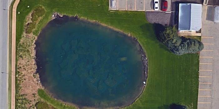
The body of missing Davie Lee Niles has been found thanks to imagery captured by Google Maps. The satellite images captured a car at the bottom of a funeral home pond last week.
Details supplied by the Kent County Sheriff’s Department in Michigan state that Niles had been missing since October 11th, 2006.
Nile’s son-in-law was relieved the search could finally come to an end.
“For us today, it’s a closure of a long search,” he told WOOD-TV. “Why God waited nine years, I have no idea, but we’re happy. It’s good to have him home” he said.
Google maps has in the past picked up other sinister incidences.
Last year, the site’s all-seeing satellites managed to pick up an image of a man who’d been beaten, shot and left to die on a California railroad – calling into question the integrity and necessity of the worldwide mapping system.
The technology also claims responsibility for reuniting Saroo Brierly with his family. A 2013 ad for the service tells the story of Brierly’s 25 year search to find his biological parents.
Artist Jon Rafman has correlated google’s inexplicable images for his 9-Eyes project.
He says, “(Google Maps) represents a new type of surveillance very different from the totalitarian version depicted in books like 1984.”


